Day 10 17 miles in 10.5hrs 6.30am-5pm
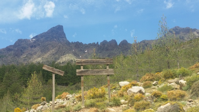
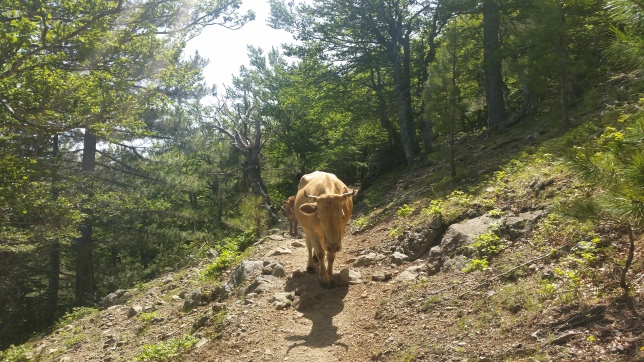
After another restless night and waking up before 6am, I broke camp about 6.30am. Stepping over the stream outlet is the humble source of the mighty Kings River of the Central Valley most Californians know. Up the rocky switchbacks and past the campsite, I made the slow climb towards Muir Pass, the wooded trees now gone, the path weaves up rocky boulder terrain, following the small stream up to towards Helen Lake, a small lake first crossing the river and meeting a couple of south bounders rising out of their tents perched pitches between the rocks.
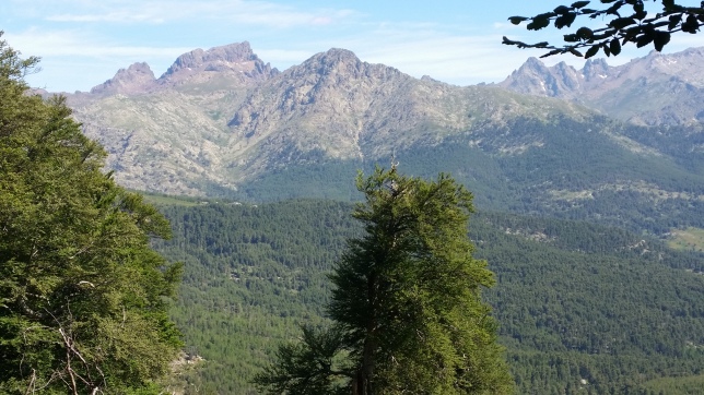
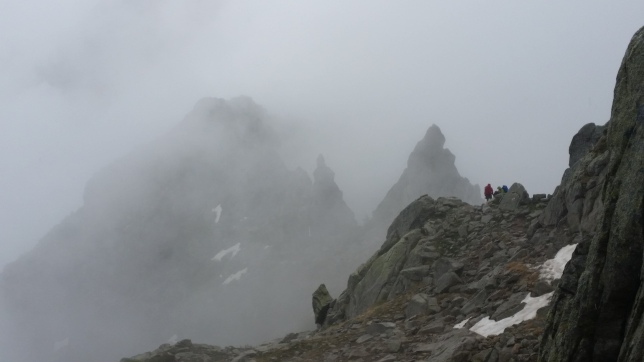
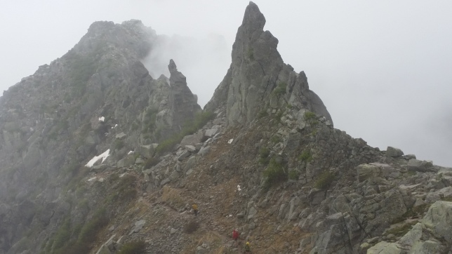
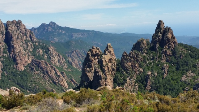
Looking back the peaks had an almost biblical light, sunrising out of cloud shading various colours on the mountain backdrop. Upwards again to Helen Lake, walk round it’s left side and the switchbacks rising above it. The path and stream were one and same for a short stretch and it over and back up the last few switchbacks before the Muir Pass hut came into sight. It was a great relief, still early I think around 10am, but as always on the JMT further than I had expected. I went inside, took a break and met a Swiss PCTer carrying a large guitar. We chatted all things trail for a while on the descent to Wanda Lake. The flowers here even at altitude were pretty, and the trail skirted the right side of the lake, mosquitos were out but blown away with a few gusts of wind. Cloud darkened the sky and for short while I wondered if this would be a thundery day. I filled up and dip my cap in preparation for a long descent.
As I walked down the rocky path of Evolution basin, I had to take care, a few slides and I could feel the heat as mid-day approached. Passing several South bound groups on the way down, I snacked and hydrated as I walked beside sapphire lake on my right. Lower down a river crossing with large stepping stones took us over toward Evolution Lake. The path levelling off and walking round the lake there were deer on the slopes above, at the end of the lake some hikers basking in the sun. It was cloudy and high peaks all around but the temperature was high. After the campsite the trail descends again, more trees appear, the path crossing small streams before dropping down steeper into the forest, the heat was building. A creek crossing at the base wasn’t too bad in this dry season and the path eased off again.
A river canyon, a meadow and with trail undulated towards McClure Meadow. Passing campsites, I kept going, marching at some points as my pace picked up in easier gradient. Eventually at a signpost I took the alternative crossing, a quick route across the meadow and evolution creek, I put my water shoes on and the mosquitoes attacked with fury. I moved quickly to get across and put trail runners back on, it was frantic as they followed me a short distance. Now safely on the other side, I kept up the pace to avoid the bugs, but just after the main crossing where the river falls to the valley below, I stopped to refill water and cool down in the shade. Although I had descended far, I had one last drop to go and reach a camp spot. This the hottest part of the day, the clouds had gone, I was ducking for cover down the tight switchbacks, it seemed to go on forever, such a long way down from where I had started the morning.
At the bottom is the south fork of the San Joaquin River, crossing a well-made bridge there was a small camp spot but already taken by a couple of hikers. So, I kept going, I was so tired now, there was a potential spot beside to the next bridge crossing down Goddard canyon, so I carried on, the sun was dipping behind the mountains and I could feel mosquitos, I made one last push and stopped just before the bridge on the right, enough space for two tents. It was good enough for me, a 17-mile day came to an end. I dipped, washed and filled up in the creek and had ¼ of a backpacker meal sitting on a tree stump, a few hikers passed both directions and considered stopping but I think was tight. I tidied my bear canister, as the next day would be resupply day! I was relieved to be on target for this. Every day so far was trying to make the mileage to stay on track and here I was within reach.


Day 11 11 miles in 9hrs 6:30am-3:30pm
Another creek wakeup call and my body was now so used to pre-6am rises and breaking camp around 6.30am. It was 4.5miles to MTR, the previous day set me up well, I was over the bridge and following the river to Aspen meadow heading into the Sierra National Forest. The junction to MTR was further than I thought, a JMT mile seemed to be longer than other miles. And, I was soon descending again off trail to reach the ranch, the mosquitoes were out in the forest, and the mountains fell away, it felt like I was walking out of the Sierras by this point. At the last junction I passed Paul, who I’d met at Crabtree and soon after, beekeeper John. Eventually seeing Muir Trail Ranch by mid-morning through the trees, it was a great relief. I’d made my first big challenge, carrying 10 days of food to get here, now to pick up my Triple Crown Outfitters resupply bucket. I met Brian and some others who were finishing off their repacking.
It was a straightforward process, I removed my rubbish, cleaned out the bear cannister, repacked with new supplies, raided a few treats from leftovers and filled all my vessels with filtered water from the tapped sink, no-one tells you about that. I bought a much-needed bug net and Brian helped me with my drumroll new pack weight-in at 35lb which was not too bad. It felt so good switching foods, I gave away spicy backpacker pantry meals & oats, know I wouldn’t eat them. I still had to probably do another pick up somewhere before the trail ended but felt confident with VVR, Red’s & Tuolumne & I’d be good. I was happy with MTR & my resupply, didn’t really get the poor feedback, my experience was efficient and had no complaints. After hydrating, snacking and repacking I was back on my way. Back up the access trail, and then straight up at the junction this time to get back on the JMT, steep switchbacks awaited.
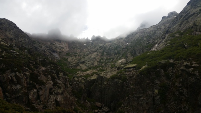
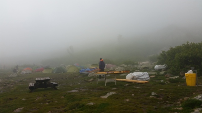
Midday heat and I had a lot of elevation to regain today. It was slow going as the forest thinned out and steep dusty switchback became shrubbery and rocky as I wound my way up off the valley floor. With new pack weight and searing heat I made very slow progress, back to stopping at switchback corners shady spots, leaning my rucksack against trees and generally going very slowly as south bounders bounded past me. I always struggled after lunch around 2pm, but getting to Senger creek seemed to be an eternity. Eventually the trail changed direction and the elevation eased a little as I breached 10,000ft again and passed some camp sites. Not much water here, so I washed and dipped my cap. By now the skies were darkening, clouds had gathered while I’d hiking back in the forest. I didn’t think much of it, until I suddenly heard a loud clap of thunder, it’s crackling seemed to be quite long and the whole sky darkened further.
I could now see back across the range towards Evolution basin and direction of Muir Pass, the depression looked bad there, but I was moving round a section where it was clearing, so I looked at the app again for camps and stopped at a section where there was a tent up. Suddenly another big thunder and lightning strike, it felt close. Fellow camper, a Wisconsin woman was glad to see me as I decided it best to stop, rain was coming. The winds picked up; I pitched on a flattish dusty area between boulders near some trees but not in direct. We chatted and discussed the conditions, I prepared for the worse and when the rain hit, we jumped into our tents, it cooled significantly from the heat only an hour or so ago. It was the first threatening conditions I’d come across on the trail. As I sat in my tent, I worried about flooding and angle of my pitch even tho I’d made sure it was slightly sloped. Anyway, we got lucky and the rain passed quite quickly, the storm took up a large part of the sky, so we waited it out as you never know if would return with a change in wind direction. After having dinner outside, I took an early night, wrapped up and tried to get a sleep.

Day 12 17 miles in 9.5hrs 6.30am – 4pm
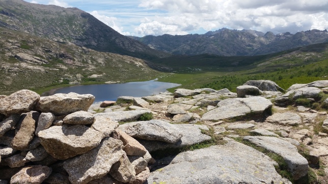
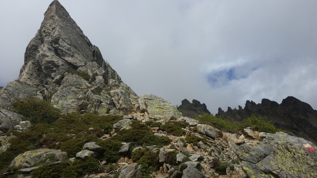
Another early start, the skies had cleared, my pitch next a viewpoint clearing back to Evolution, I broke camp at around 6.30am and was off again. I was at Sallie Keyes Lakes within minutes and saw a few tents dotted about the trees – it looked like a cool spot for camping I’d just missed out on. It was quiet, dew on the grass, the light on the first lake was beautiful, the second in shade. I filled with water at the outlet stream and the rail followed up the lush spot back onto rocky terrain, there were a few switchbacks but going up to Seldon Pass was one of the easier ascents, in the cool shade and only hitting the warm sun at the top. Incredible views over the other side overlooking Marie Lakes.
I chatted to a Southbound family who arrived just after me on all things Star Wars, as my trail name Obi-Wan (sharing the same name as the actor). Soon I was heading down to Marie Lakes, it took no time and there was a large group of people just breaking camp as I passed. The descent from there was pleasant moving down into forest, passing a meadow at Rose Lake junction, and an easing slope before some switchbacks to a large crossing at Bear creek. I switched into my water shoes and quickly dried off the other side as mosquitoes attacked. Following the creek down, meandering through a forest, I stopped at slabs next to the river for lunch. I’d passed many south bounders in the morning, and overall so far not many north bounders passed, I had a tuna wrap, some electrolytes, filled up and moved on as the bugs were annoying. The trail passed through lush area, steams over the path, green forest damp underfoot, so ideal for the bug, it was cooler for a while but then the trail started back uphill, passing bear creek trail junction.
My pace slowed again in steep dirt switchbacks, I hadn’t expected it and the heat returned as I gained elevation around mid-day. I hadn’t planned to stay at VVR but many south bounders had said I should go, as I ascended slowly, the idea started to fade whether I could make it today. Then, suddenly a north bounder passed me, it didn’t happen to often, and we chatted, I tried to keep up behind them. Purposely trying to get to VVR, he lost me on the steep switchbacks. Although out of sight by then, I pushed myself and used it to see if I could energise myself. Now, nearing the top of a ridge the path elevation looked back over the valley, trees were thinning again, and the slope eased, moving round to flattening wide forest. I picked up the pace and started to try catch that hiker, we still had a descent to reach the lake that has a boat service for VVR. Pushing on and the trail now started to head down the other side, switchbacks were back and I’m pretty fast on descent. Soon, I had caught up, shouting to egg him, it was Jake from Austin Texas, shouting V-V-R and pushed the pace. By now it was 2.30pm, cloudy and cool, the last ferry was 3.45pm, we had just over an hour to get down and catch the boat. The switchbacks were dirt and steep, not easy on the knees but I was good for it, just one slip had me graze my leg, but we were determined to make it now, the chips were all in.
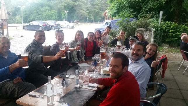
I don’t how we did it but we made it, it was a much longer descent than I realised, plus the walk to the lake and half mile along the lake bed beach really pushed my limits. I got to the water’s edge, met others waiting and Jake arrived as the ferry dropped off Ledge gal and others. It was a small boat, we waited on the next and soon myself Jake and Paint (boat guy) were flying on a tin outboard across lake Thomas Edison. It felt dramatic, a few miles and we’d be at a resort with beer & food. Jake had booked a room, I offered to pay for a bed, which I was so appreciative of. I was so exhausted arriving at VVR. At the store, I picked up some sodas and a beer, and choked on the first soda, my throat was so dry. But relieved and glad I’d pushed myself and met Jake to make it there. Although I had resupplied the previous day, 12 days in the wilderness was taking its toll, it really felt like a survival exercise. The longest camping trip I’d been on, I was shattered. Having showers, chilling and eating from a restaurant. We high-fived a few trail buddies. I had a burrito for dinner, some beer and chatted with fellow hikers before hitting bed.

Day 13 VVR Zero-day
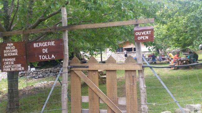
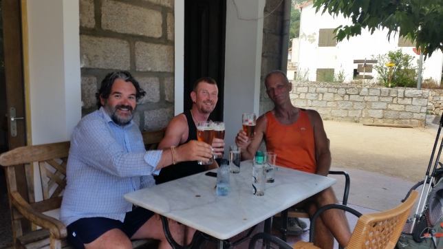
Next day was spent at Vermillion Valley Resort, a long lie in and leisurely breakfast and sitting outside in the café. I spent most of day pottering about doing laundry, cleaning, charge batteries, repacking my bag, having lunch, using Wi-Fi, drinking beer and chatting about the trail. A dinner of pesto pasta with the gang, and shared teaspoons of my 30-year-old single cask Scotch whisky with folk round the campfire. Ingitha who I’d met pre-trail back in LA and travelled to horseshoe Meadows with arrived, it was so good to her. She and others told their story of the storm we’d narrowly missed the night before, I was right it was bad up near Muir Pass/Evolution valley, they had the worst of it, hiding behind boulders. VVR was an unexpected add-on but well worth it to rest, relax and recover. Big up to Jake who had the foresight to book a room Everyone talks about the prices at VVR but I didn’t mind, it’s so remote and is an oasis in the backcountry. I ate and enjoyed other peoples company, I am so glad to have done this.

Day 14 12.5 miles in 7.5hrs 10.30am -6pm
Next morning, after breakfast we’d be heading on the 9.30am ferry shuttle, waving goodbye to fellow hikers from the pickup truck, to the shore and waved off by Meg, the VVR owner. Back on the other side of the lake, Jake, Gina, John & girlfriend all headed into the woods of the Mono creek trail for a mile to re-access the JMT at around 10.30am. Once back on the JMT Gina & Jake were faster so disappeared up the switchbacks into the distance. Passing Mono creek junction and heading upward my pace slowed, I was back on my own again. But they waited for me at Silver Pass creek with its waterfall, a chance to fill up and filter – Gina had a super-fast Katadyn filter.
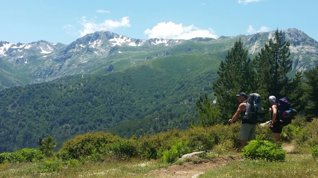
Some of the steepest sections of the trail were ahead of this, sometimes there were no switchbacks, just straight up, but eventually rising above trees and the valley below to the next set of peaks ahead and tree-less Sliver Lake on the right. Gina & Jake waited again for and we met up again with hiking Rev just before the false saddle small lake and last few switchbacks up to Silver Pass. At the top we gathered and took some pictures together. Another pass with incredible view sweeping across the Sierra range with bright blue alpine lakes below. Joining us on the descent was PCTer Milkman, we had the starting of a tramily, chatting as a group on the way down, talking about favourite movies and actors.
Filling up at Squaw Lake (now renamed), we heard beekeeper john shout from Seldon pass. Further down I headed the group to get us to camp, Jake suggested nearby Fishcreek, it couldn’t come fast enough, we arrived at camp around 6pm and the bugs were out. It was tight for spots, so Milkman decided to carry on. I was a bit grumpy and tired but pitched just above the others and cooked dinner. Gina insisted we all eat together on the rocks above the bridge, so we all went up with the south bounder camping with us and looked over the valley, it was a great spot and good end to the day. Jake shared some hot apple cider and we headed down for bed as the bugs got worse.

Day 15 13 miles in 8.75hrs 7.45-4.30pm
As I got up out of my tent, hiking Rev was quietly breaking camp and the rest of us started moving about. I broke camp soon and headed to the bridge for water, knowing Gina & Jake were faster, they’d soon catch me up. Access to the river below the bridge was a bit tricky, but I got filled up and was soon on the trail as it snaked upward to start. Along the lush valley I wasn’t quite sure which mountains the trail was heading for, until switchbacks headed up left of Tully Hole, probably the surprise pull up of the trail, possibly because it came first thing, I was glad we’d never carried on further last night. It was a steep start to the day, and no-one caught me up. South bounders glided past me I slowed moved uphill. Then, the path swung out wide to a very long switchback upwards and finally it was over to a view of Virginia Lake, I could hear voices of groups camping and hanging out there, it seemed a popular spot. The path weaved round to the right and I stopped lakeside to dip my toes in the water, fill & filter. I caught up with hiking rev, so we headed off together and still hadn’t seen the others, it was a short lived tramily. After the lake, the path rose once again with a few more switchbacks with views back to the lake, then it was onto the next valley. The scenery was excellent, passing a rocky scree on the left before dipping down again on switchbacks towards Purple Lake, it was a lovely spot. Someone was fishing and we met a ranger just above, where we had a good chat and caught up with Jake again. Soon after a large packer group of horses passed us. The next stage we turned to contour round a forested shoulder with sweeping views across the valley. It was hard to escape the scorching sun, we’d been in shadow going down to Purple Lake, but this sunny side, there was little shelter in shade of trees. Up and down to Duck Pass junction and the outlet was a good spot to stop for lunch and break, hiking rev took a short nap. The next section was steadily grinding us down, the pace slowed, although not steep upwards just undulating round and we were both quite tired in the heat. We agreed to camp at Deer creek, the nearest source. One last look back to Virginia Lake direction and we’d turn into another set of mountains, a short downhill, flattish area with great spots appeared but we waited for the watery creek. At around 4.30pm, it was pleasing to find this lush green oasis, we pitched beside the trail and others nearby. I washed some clothes, filled and filtered before dinner. We turned in early as the bugs were out and both pretty shattered.

Day 16 15 miles in 8.5hrs 7.30am-4pm
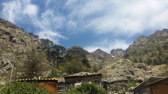
Next morning, when we broke camp, hiking Rev said to go on ahead, he had a different itinerary and only a few miles from Red’s Meadow where he was meeting a friend – so wanted to take it easy. Soon after I left camp, at the next campsite, Jake shouted me from his breakfast spot just off trail, I went over and had a chat, he too was meeting up in Red’s with his family, so I knew then I was going solo for this next stage. The trail wound its way to Crater Creek with it’s double trunk bridge. Soon after is a descent with switchbacks, peeking through the trees to another range of mountains, I wasn’t sure which my direction for Donohue pass. Horse riders passed me on the way down and I entered the eerie landscape of Crater Meadows tall branchless tree trunks, burned and twisted.
I was now near Red’s, I had thought about it as an option when planning the trip, but since I’d stopped at VVR, I felt I was good for supplies. So, I carried on past the junctions, PCT and headed to the wooden bridge across the river. I stopped just after to fill up and take a mid-morning snack. The trail was quieter here, some day trippers but I surprised since it was so near a resort. As a trail low point, it was enviable path would take an upward turn, so I followed this and looked across from the opposite side of the river Devils Postpile & Red’s Meadow. I didn’t take a detour for the national monument; I could see it across the valley and there was a great viewpoint showing on the Far-out app. It’s quite an incredible feature, looking back, I probably could have gone closer and re-joined the path quite easily but I didn’t really want to lose the path or height by that time.
I passed rangers and a group upgrading the path and further up at Minaret Creek, I stopped after the wood bridge to fill up and have lunch around noon I filtered quite a bit for the next section, it was getting hot, so I soaked my feet in the water, dipped my cap and talked to a few hikers. It took an age to digest my tuna wrap, I really struggled to eat in the heat but needed the calories. For the rest of the afternoon, it would be a steady climb up to Gladys Lake, my pace slowed right down in the heat, although much of in shaded forest, it was humid. I stopped many times, felt tired, there was no-one to push me onwards. But eventually, I made it and I decided to push on to Rosalie Lake, up a little more and round the lakeside, it’s a beautiful spot with surrounded with peaks. I passed the first camp, a group had taken, so I camped off trail near the end of the lake. I pitched my tent and then went for soak and washed some clothes. I was tired but happy with progress, other hikers joined me nearby and as the sun sank over the tops, it was getting buggy, so I took an early night. Nearly 15 miles with not pass as such but always elevation drops and gains on the JMT.

Day 17 13 miles in 9hrs 7am-4pm
Next morning, I was up slightly later, and broke camp for 7am. Carrying my shake and protein bar, I started the switchback decent to Shadow Lake, noticeably quite far down, I thought to myself, and on the JMT that always means they’ll be a reascent on the other side. I stopped to admire the lake, all these lakes are beautiful and at Agnew Meadow junction wooden bridge, I filled up with water again. I flip flopped with a couple of hikers that day. As we climbed the next section, not a pass but it felt like, up and over to Garnet Lake. Which I actually thought was Thousand Island Lake, I’d seen so many alpine lakes, but this stood out with mount ritter peak taking up the horizon.
Down at the Lake outlet bridge I stopped again to fill up and chat with hikers. The path now curved round the lake and up and over to the junction. I was starting to get hunger, so stopped at a lovely spot Ruby Lake, secluded much like Rosalie Lake. I sat against a boulder in the shade, it was quiet this stage, just a few hikers passing. I thought I see much more people in the northern section with Thousand Island Lake nearby, but even there it was quite quiet. Out of the forest and down to Thousand Island Lake, the breeze picked up. The stepping stone crossing and PCT junction, the landscape was incredible, Indian paintbrush flowers on lush green grass next to the deep blue lake, purple and lime green butterflies, chipmunks skurrying behind rocks, and the grey granite & snowy peak of Mount Banner centre stage overlooking the dotted islands.
Green forest and sun-bleached rock surround, it’s a postcard scene. I didn’t hang around, although breezy it was still hot and exposed, I carried on up the rocky path to another viewpoint where I stopped and chatted with another hiker admiring the view. Turning away, the path headed steadily towards Island Pass, it wasn’t steep, probably the easiest pass and similar to other sections not classed as a pass. Walking past a series of small lakes and flattish meadow. I kept going and then dropped down the other side, I met several south bound groups but no-one passing northbound. Stopping at a creek to fill up again, I started to feel the hottest part of the day. Another climb back with switchbacks up rock ground I started to think about campsites. It was normal by now to just go with the flow and not really plan ahead, just look at the Far-out app and assess as I went. I chatted with more south bounders who had recommendations.
Over Rush creek I filled up as probably my last water source for the day. Following the path over slabs, seeing others pitch tents in the shady trees, I kept going, approaching a pond and meadow area, I looked around. I didn’t need to go higher, Donohue pass wasn’t so far, so I picked a spot just before a rise, not on the meadow, but off trail to the left next to a few large boulders. I cooked mac and cheese for dinner, and enjoyed the light fade back over Thousand Island Lake area, a quiet peaceful spot near the meadow and still no-one passed by.

Day 18 21 miles in 11hrs 7am-6pm
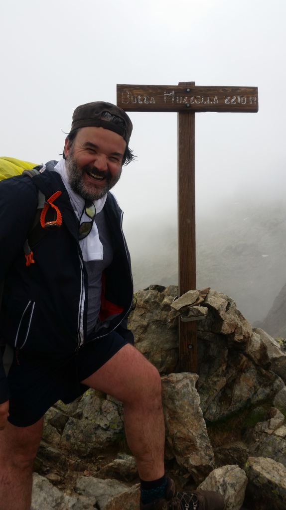
After making coffee, I broke camp around 7am, dew still on the grass and cool, it was a favourite time, stretching and anticipating the day ahead. A slow meander beside the river, the path moved steadily upward but not steep, crossing the river I filled & filtered and stopped at a nearby boulder to bask in the morning sun. I wasn’t sure which peak direction was Donahue but the path moved left and then further up sharply left again with some switchbacks. By 8.30am I was on top of Donohue Pass. This was a milestone for me, I wasn’t counting mileage or anything, I had reached Yosemite national park, a lifetime ambition, but I walked to get here.
The peaks around were incredible. In the distance a pink haze and my end goal of the Valley. A quick stop to take in the moment and I was off down the other side, snaking down the switchbacks, over to Lyell Fork Lake where several marmots ran across the path. Round and down quite steeply in awkward stones, passing several south bounders coming up. As I stopped and talked to some the talk of wildfires and smoke in the valley was the main topic. It was a little startled, as so far, I’d managed to avoid these issues, so asked what the best practice was in these situations. The further down to Lyell Canyon I got, the sky got hazier and the stories grew of the latest fire nearby. It was a long descent to the valley floor of Lyell Canyon, then the path took the left edge beside the meadow and river.
It’s a beautiful area, I passed many south bounders and trail runners (a popular route). However, coming down the valley the hazy was thick, that distant pink haze high above tops I’d seen from Donohue Pass, I was now in it and could hardly see the mountains around me. I pushed on over boulders with small stones to guide hikers like an airstrip. Heading to Lyell Fork, then down to Tuolumne, I met a ranger who updated me on the 8-mile camping exclusion zone and said the store was 2 miles away. I was getting tired, there were more day trippers on the path and eventually I found the bridges at Lyell Fork, it was so hazy and many tourists now. I was struggling and really felt fatigued, I wanted to find the store and asked others but most were in cars. At the car park I walk down the side of the road and over Tioga Road bridge, tired and grumpy I finally made to the Tuolumne Meadows store. I threw down my backpack and greeted a few hikers. I picked up snapples, sodas, snacks and ice lollies. I devoured the sodas quickly, my dry throat parched in these mountains, hard candy was useful. I got rid of litter, replaced a dishevelled Smartwater bottle and got the pack back on. Tuolumne was a twilight zone for me, I couldn’t find the store, then getting back on trail, I hiked down an unsigned new built closed road at Lembert Dome car park for a quarter mile, to reach a wide JMT/PCT path that turned and almost went back to the store at highway 120 for Cathedral Lakes direction.
I was so confused and then I met another ranger at Cathedral creek telling hikers they must reach Cathedral Lakes 3.5miles away or go to the road and hitch. By now, in the hazy smoke and super tired, it went against all my mountain sense to hike up further into smoke because of a camping law. But, I’m law abiding so I did just that. I was nervous, not knowing what to expect, light was fading in the hazr, deer ran across the path to hide, and the path was quite steep uphill. Passing Cathedral Peak I could just make out the incredible slabs going sharply to the sky. The eerie light changed and became dark in the forest, strange dark trees and figures, at one point I felt shivers up my spine, I thought there was a bear standing on the trail in front of me. It was creepy and no-one else around, then the light came back as I hiked above the hazy section.
A sign for Lower or Upper Cathedral Lake, I took upper, keeping height seemed sensible and now I was looking for a campsite, a few clearings but nothing great, then a wide section on the right near the lake appeared, I grabbed it, 6pm and 21 miles for the day, I was absolutely exhausted. I heard a couple of other hiker’s camp nearby. I pitched quickly as the bugs gathered and while making dinner the sun appeared through the trees, I walked over and saw an incredible wildfire sunset, shivers again, but in a good way, nature at its purest, I felt very alive, simply breath-taking the bright red sun dipped into the hazy and the sky became pink. I took pictures as darkness fell quickly and headed to bed.

Day 19 18 miles in 7.5hrs 7am-2.30pm
Next morning, I was up around six and broke camp for seven. I hadn’t really thought much about it but this could be my last day on trail, I still had days to spare on my permit but the wild fire was my immediate concern and still focussed on finishing the trek. It was a crisp clear morning only a few minutes in and I was at a view point looking back to Cathedral Peak in all it’s glory with the sun trying to get out from behind it. It was incredible just before sunrise, I walked along Cathedral Pass a meadow that looked like Provence with clumps purple lavender but I don’t think it was lavender. I passed a couple of early south bounders, the going was easier as I headed to Sunrise Lakes, still the occasional uphill outcrop but in general there would be a big descent today Passing several campsites, and stopping at a small creek to fill up, I passed a family camping and butterflies fluttered across the path. Purple daisies flowed the path’s edge and lifted my spirits.
I felt much better in this clear day away from the hazy, hopefully I’d seen the worst. I had a lot of descending to do, with steep switchbacks, leading down in the forest to flatten off to the strange charred trees at Forsyth & Merced Lake junction, following Sunrise Creek down through the forest. At Clouds Rest trailhead and looking to the back of half Dome, I stopped to ponder what could have been. In this descent the haze had returned and I could now just make out the peaks in the valley opposite. I had applied for a half dome permit and heard Clouds Rest was a terrific viewpoint. But now I just wanted off trail to safety, there was no point in going back up into smoke, who knew what the conditions would be like.
More steep descending and the haze deteriorated all the way down now, from such a clear start to the day, an anxiety returned. At Little Yosemite Valley camp I took a break to sit and have lunch. It was peaceful and quiet but quite a few tents. At the Mist Trail junction, I spoke with a family who knew the area and recommended I go down the Mist trail for best views, so I took their advice. The flat wide quiet trail above now turned into a steep staircase down full of day-trippers hiking up. Going down steeply with a backpack is quite tricky, gravity wants to throw you forward. Nevada Fall was simply stunning, even in the haze, it was awe-inspiring, From being above, it was quickly high above me. Every step people came coming up and I was going against the traffic.
My legs were wobbling with all these sharp downward motions. Eventually reaching Vernal Falls, where hundreds of people were bathing in the pools. It felt strange, here was me trying to get off trail safely and concerned about the wildfire but everyone else was hiking up to take selfies. I pushed on down, it’s an incredible drop down, I had to walk round back to take the next staircase which and even more people, I stopped at fountain and restrooms. As the path became tarmac, the peaks around were in the mist, it reminded me of the Chinese paintings you see of the mist-clad Yangtze River, quite dramatic with the naked eye but would never come out in photo. As I walked the last mile following the Merced River I felt some emotion, finally I was here, the JMT Happy isles just ahead, the last 19 days on trail flooded to a moment, among the crowds, I felt alone and melancholy. I’d like to have had a trail buddy to high-five or some way to celebrate. As I arrived at the trailhead, I couldn’t find the mileage sign that everyone takes a photo at. I was disappointed and took a selfie at the bridge. So, I went over to the Happy Isles visitor centre but they couldn’t help me, because I’d taken the Mist Trail down, I had missed that opportunity So, disheartened I walked back to the bus stop and joined the other tourists taking the shuttle bus to the store.
It was an empty feeling in the end when it should have been a high. I’d met so many people, but there were none around. I got to the Yosemite Valley Visitor centre who told me highway was closed for my route, so I had to take a bus to Fresno, due in half an hour. A 3.5hr drive south, to then go north the next day. At the bus stop, I ate snacks and booked a hotel room in Fresno. It was a surreal experience, on the bus, the driver, over the mic pointed out various forest fires vintages, roads were closed, firefighting teams were stationed at junctions and we stopped at Fish Camp where they were selling tee-shirts of the latest fire. I bought a sandwich and sodas for the ride into Fresno.

For the hike I trained in Scotland climbing Munros, I found the heat & altitude affected my appetite – in future I would skip expensive backpacker meals for inexpensive options like mash. Some of my gear let me down despite shakedown hikes. Ultralight gear worked for the most part, but I did find some nights cold and would change a few things if doing again. When I hiked the JMT it was a heatwave dry season conditions, with a couple cold nights. I will likely put a post on gear if helps people.
And, you can watch my adventure here on YouTube
Here’s My 2022 Northbound route GPX file – it’s a Cottonwood Pass start, via MTR and the VVR ferry to finish on the Mist trail Happy Isles exit point, with the Tuolumne Meadows campsite detour

All things considered, it was an epic trip. After speaking to so many on the trail, I would like to revisit and walk shorter loop routes, like Rae Lakes, Big Seki and also hike Yosemite Valley when not in wildfire conditions to see what I didn’t get to see.
But also go with friends to enjoy the experience more, I missed that, and despite many people saying the trail is busy, I was really surprised at how quiet it was in high season mid-July. Many were going the opposite way, but not so many going north on a similar pace.
Slàinte Mhath